This exhibit showcases images of early Massachusetts airport sites, landing fields and airports attributed to the Massachusetts Aeronautics Commission. These photographs were part of the collection of the Massachusetts Aviation Historical Society.
The Massachusetts Aeronautics Commission was created in 1939. It was developed to reorganize aviation regulation in Massachusetts and take advantage of federal funds for such things as building airports. Formerly the regulation of airports, pilot licensing and aircraft accident investigation was under the jurisdiction of the Massachusetts Registry of Motor Vehicles' Aviation Division. The Registry didn't focus on promotion or development and there was a need for more systematic and consistent oversight. Tailored to the 1938 Uniform State Aeronautical Act from the National Association of State Aviation Officials, legislation for the Massachusetts Aeronautics Commission called for a seven-member, bipartisan, unpaid commission directly responsible to the governor, with a full time Director of Aeronautics. Crocker Snow was selected as its first Director of Aeronautics.
The Aeronautics Commission grew out of the Committee for Aeronautics that had been appointed by the Governor of the Commonwealth of Massachusetts on September 7, 1935. The Committee for Aeronautics was formed for the purpose of directing the use of Federal Work Funds for Aeronautics Projects. This Committee inventoried then existing facilities in order to determine their potential value with a view to future development.
One of the first obligations of the Massachusetts Aeronautics Commission was to prepare a plan for the development of airports and air navigation facilities in the Commonwealth. In cooperation with the Public Works Department in 1939, the MAC inventoried existing facilities, and related them to the department's highway plan which included a circumferential highway - #128 - surrounding Boston and extending to the Atlantic on both ends. Mr. Snow states: "Working with maps and visual reconnaissance, first from the air and then from the ground, we picked four airport locations, approximately equally spaced along the path of what would be Route 128. The locations were in South Weymouth, Norwood, Bedford, and Beverly. We also strongly recommended a second major airport to relieve congestion at Boston."1
As World War II in Europe expanded and belief that air power would play an ever increasing part, the President and War Department instituted the Defense Landing Area Act (DLA). It was assumed that coastal military airports in the northeast would be strategically useful during the war and valuable commercial assets afterwards. The DLA directed the United States Corps of Engineers to build an airport at any location agreed upon by the Army Air Corps and the Civil Aeronautics Authority if a local public agency provided the necessary land.
In 1940, MAC developed a preliminary state airport plan designed to create airports adequate to the needs of military, commercial and private flying as part of a continuing program designed to take care of such future needs as could be reasonably foreseen. The plan was approved by the Civil Aeronautics Administration and the War Department for the DLA participation in December 1940.
1. Snow, Crocker. Log Book A Pilots Life. Washington: Brassey's, 1997.
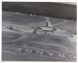
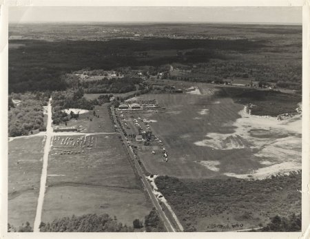 Hanover June 1940
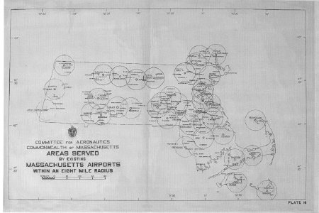 MA Committee for Aeronautics Map